Synex
Strong Quake Rattles Southern Peru
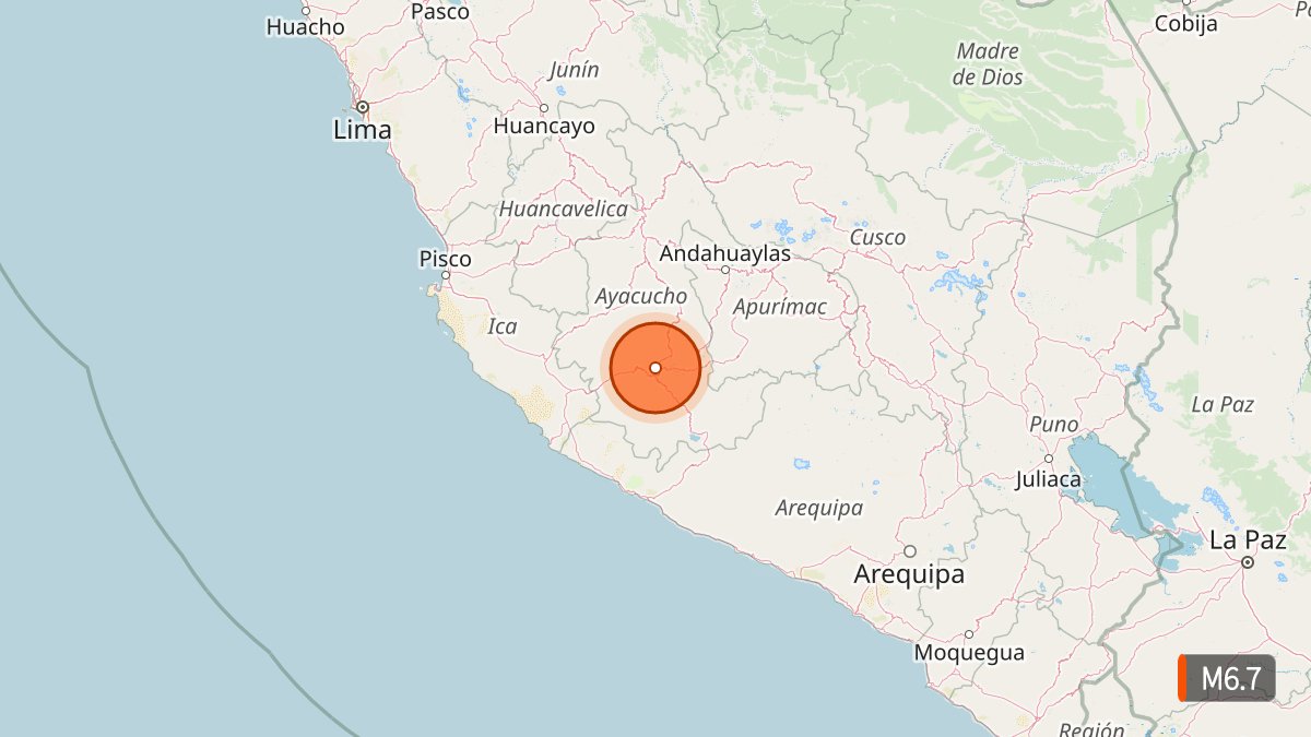
Strong Quake Rattles Southern Peru: What We Know About Today’s Seismic Event
A powerful earthquake struck southern Peru on Thursday afternoon, sending residents into the streets and triggering rockfalls in the Andes. Officials confirmed limited damage and no fatalities as assessments continued into the evening.
Magnitude Reports and Epicenter Details
The U.S. Geological Survey recorded a magnitude 6.7 earthquake at 1:00 p.m. local time on August 20, 2026. Peru’s Geophysical Institute (IGP) initially reported magnitude 7.2. Such differences are common across seismic networks due to varying data and calculation methods.
The epicenter sat roughly 35 kilometers north of Coracora in the Parinacochas province of the Ayacucho region, or about 31 to 38 kilometers northwest of Aniso and Upahuacho. Depth estimates ranged from 66 to 108 kilometers. The event registered intensity III-IV on the Modified Mercalli scale near Coracora.
source: USGS via public seismic monitoring feeds
The quake was felt across multiple regions, including Ica, Arequipa, Huancavelica, Apurímac, Cusco, and lightly in Lima. Authorities ruled out any tsunami threat because the epicenter was inland and the depth was significant.
Impacts on the Ground
Two people sustained injuries while evacuating homes in Coracora, according to Civil Defense officials. Preliminary reports listed damage to 22 homes, six health centers, and one school in districts including Puquio, Pullo, Coracora, Upahuacho, San Pedro, and Pichari. Rockfalls and landslides occurred on hillsides near Coracora. Some areas experienced power outages affecting thousands of users. Regional schools planned closures on August 21 for structural checks.
The significant depth of the quake limited more widespread destruction, according to IGP director Hernando Tavera. Residents evacuated calmly in many locations.
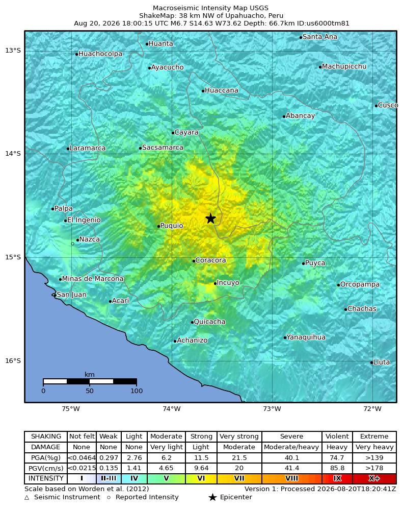 source: USGS ShakeMap
Peru sits on the Pacific Ring of Fire, where roughly 85 percent of the world’s seismic activity occurs. The country regularly experiences quakes, and preparedness measures helped keep impacts contained this time.
Watch related video coverage of the event and early responses: First images of the Ayacucho quake
What did you feel if you were in the region? Drop your experience in the comments, hit like if this update helped, and subscribe for the latest verified seismic reports.
Readers can write and read similar articles at Synex.
#PeruEarthquake #AyacuchoQuake #SeismicAlert #RingOfFire #EarthquakeUpdate
Sources
- U.S. Geological Survey (event us6000tm81)
- Instituto Geofísico del Perú (IGP) National Seismological Center
- Associated Press, Reuters, and official Civil Defense statements
Enjoying this article?
Join Synex to get notified about similar articles, discover new content, and share your own knowledge with the world!